

SAN ANGELO, TX — A flood watch remains in effect through 4 p.m. Friday for the Edwards Plateau, western Concho Valley, Permian Basin and Trans-Pecos as widespread rain and occasional thunderstorms continue, with additional showers possible into Saturday morning, the National Weather Service said.
Forecasters said most areas have a medium to high chance of receiving at least 1 inch of rain through Friday night, with 1 to 2 inches most likely. Totals of 2 to 4 inches are possible over the western Concho Valley and Edwards Plateau, and localized amounts exceeding 6 inches cannot be ruled out. Rainfall began Thursday afternoon, peaked early Friday morning, and is expected to taper by Friday evening, though low chances of showers may linger into Saturday morning.
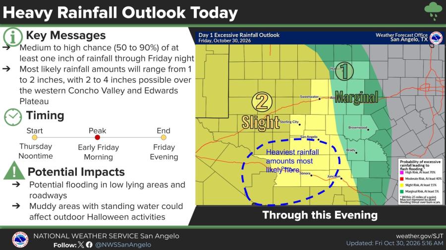
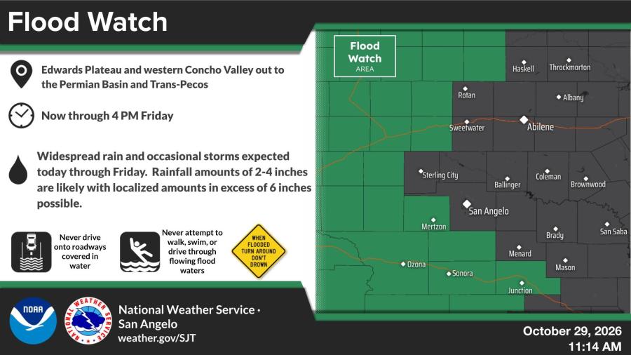
The heaviest rain is most likely across portions of the Edwards Plateau, raising the risk of flooding in low-lying areas and on roadways. Standing water and muddy conditions could also affect outdoor Halloween activities, the weather service said. Residents are urged not to drive through flooded roadways.
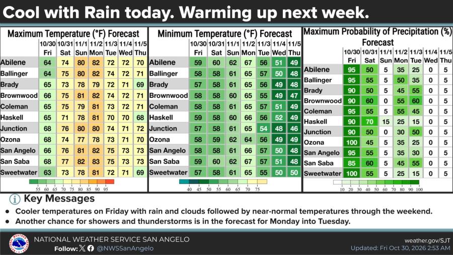
Temperatures Friday will remain cool under the rain and clouds, with highs mostly in the mid-60s. Conditions improve over the weekend as rain chances drop. Saturday highs are forecast in the mid- to upper 70s, with only low chances of morning showers that should decrease by evening. Sunday looks drier and warmer, with highs near 80.
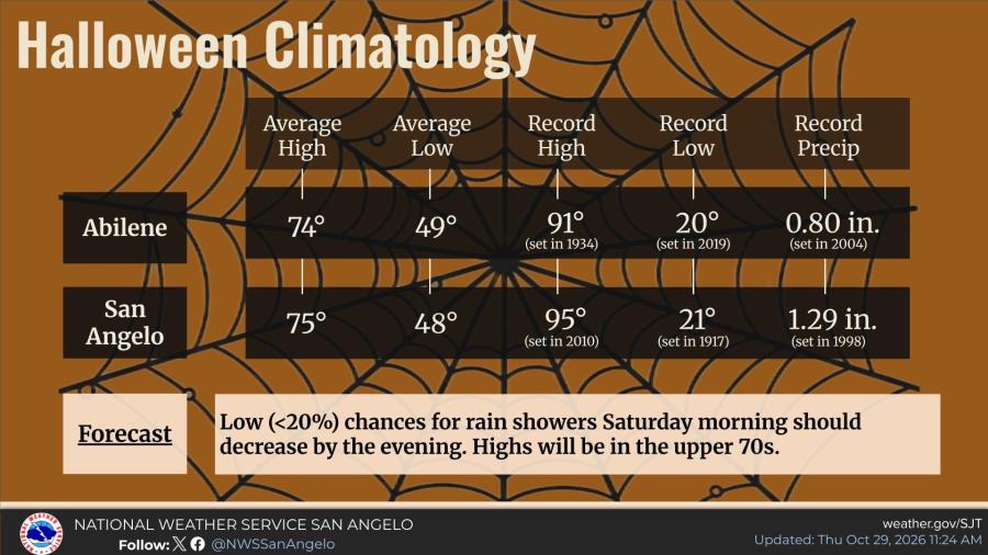
Halloween is expected to be generally mild across west central Texas. Average highs on the holiday are 74 in Abilene and 75 in San Angelo, with average lows near 49 and 48, respectively. A few scattered showers remain possible Saturday morning before tapering off in the afternoon.
Another round of showers and thunderstorms is possible Monday into Tuesday as temperatures trend closer to seasonal norms. Daylight saving time ends this weekend; clocks should be turned back one hour from 2 a.m. to 1 a.m. Saturday night.

Subscribe to the LIVE! Daily

Required
Post a comment to this article here: