
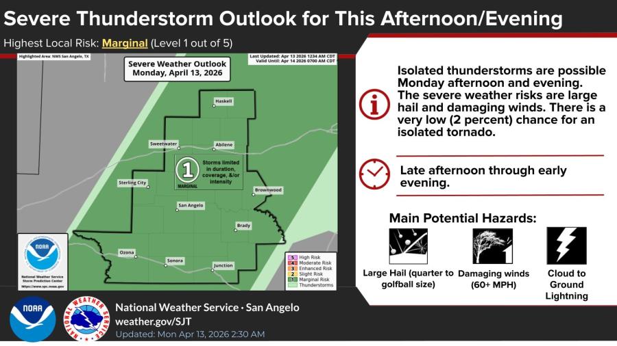
SAN ANGELO, TX — Isolated thunderstorms capable of large hail and damaging winds are possible across much of the San Angelo region this afternoon and evening, the National Weather Service said Monday.
The NWS San Angelo office placed the area under a marginal risk, or Level 1 out of 5, for severe weather. Forecasters said any storms that develop could produce hail up to golf ball size and winds of 60 mph or greater. There is a very low 2 percent chance of an isolated tornado.
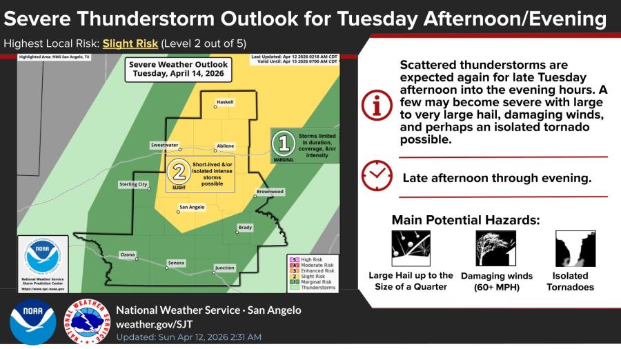
The severe weather threat increases Tuesday. The NWS has outlined a slight risk, or Level 2 out of 5, for severe thunderstorms Tuesday afternoon and evening. Scattered storms are expected, with a few potentially producing large to very large hail, damaging winds and an isolated tornado.
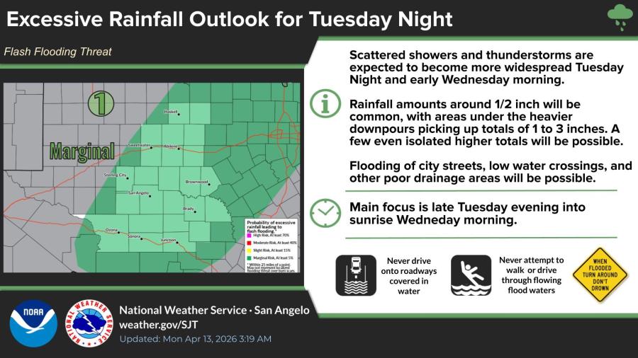
Heavy rainfall will become a concern late Tuesday night into early Wednesday morning. The NWS has issued a marginal flash flood threat as showers and thunderstorms become more widespread. Rainfall amounts of around a half-inch will be common, with some areas seeing 1 to 3 inches. Flooding of city streets, low-water crossings and other poor drainage areas is possible.
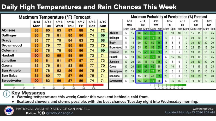
Temperatures will remain warm this week, with highs mostly in the upper 70s to low 90s. The best chances for rain will come Tuesday night into Wednesday morning. A cold front is expected to bring cooler temperatures this weekend.


")
Subscribe to the LIVE! Daily

Required
Post a comment to this article here: