
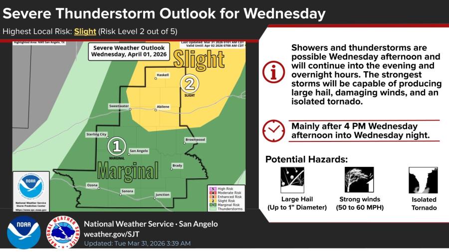
SAN ANGELO, TX — The National Weather Service has placed parts of West Central Texas under a slight risk of severe thunderstorms Wednesday afternoon and night, with the strongest storms capable of producing large hail up to 1 inch in diameter, damaging winds of 50 to 60 mph and an isolated tornado.
The slight risk covers a region generally north of San Angelo, including Abilene and Haskell. Areas around San Angelo fall under a marginal risk. Storms are expected mainly after 4 p.m. Wednesday and will continue into the overnight hours, the NWS San Angelo office said in its outlook issued Tuesday morning.
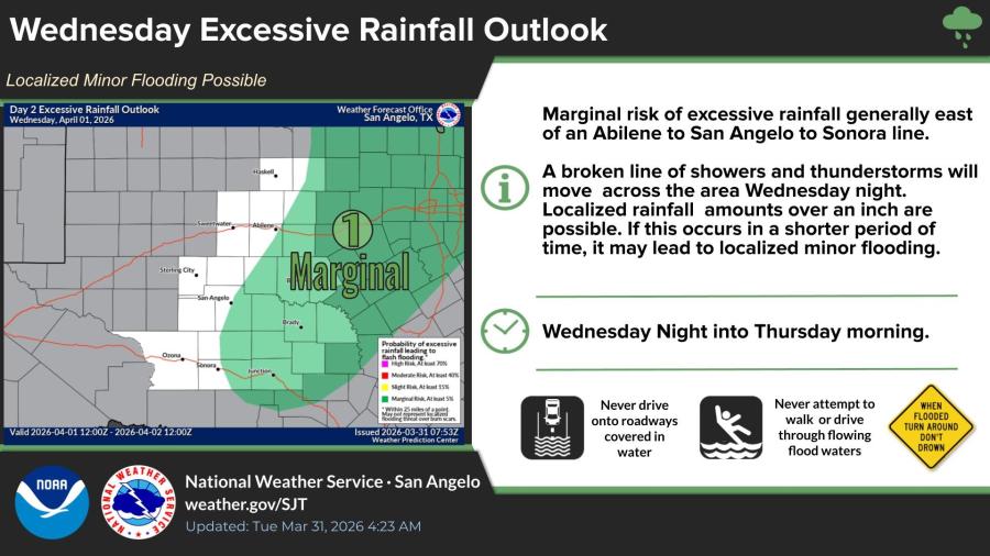
A separate marginal risk of excessive rainfall exists generally east of a line from Abilene to San Angelo to Sonora. A broken line of showers and thunderstorms will move across the area Wednesday night, with localized rainfall amounts over an inch possible. That could lead to localized minor flooding in low-lying areas, forecasters said.
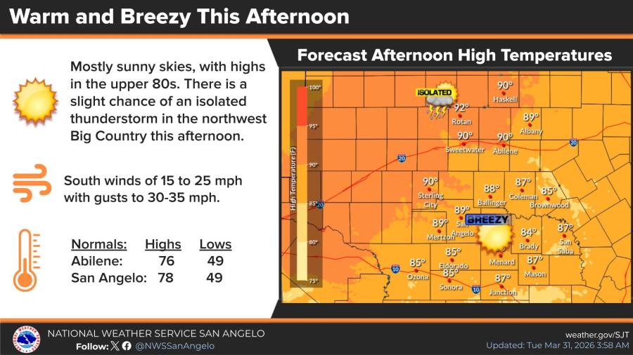
Tuesday will be warm and breezy under mostly sunny skies. High temperatures are forecast in the upper 80s, with south winds at 15 to 25 mph and gusts to 30-35 mph. An isolated thunderstorm is possible in the northwest Big Country this afternoon.
Wednesday daytime will be mostly sunny and breezy with a high near 91. The chance of showers and thunderstorms rises to 90 percent Wednesday night, with new rainfall amounts between a quarter and half an inch possible.
The extended forecast calls for a 20 percent chance of showers Thursday, then a 30 percent chance Friday and a 60 percent chance Saturday before drier conditions return early next week. Highs will range from the upper 80s to low 70s, with lows falling into the 40s by Sunday night.


")
Subscribe to the LIVE! Daily

Required
Post a comment to this article here: