
SAN ANGELO, TX — Dry, windy and unseasonably warm conditions are creating elevated to near-critical fire weather risks across much of West Central Texas on Wednesday, Feb. 25, 2026, according to the National Weather Service in San Angelo.
Forecasters warn that any fires starting today could spread rapidly and become difficult to control due to low humidity, breezy winds and abundant dry vegetation. Officials strongly advise against outdoor burning and any activities that could spark accidental fires, especially from noon to 7 p.m. Humidity is expected to fall to 10% to 15%, with west winds at 15 to 20 mph and gusts up to 25 mph. High temperatures will range from the upper 80s to lower 90s across the region, including near 90 in San Angelo, Abilene, Junction and other areas.
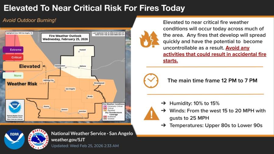
The NWS highlighted the main risk window as midday through early evening, with the highest concerns in areas shaded elevated on fire outlook maps covering counties around San Angelo, Abilene, Sweetwater, Brownwood and southward to Sonora and Junction.
This elevated risk stems from a combination of very warm temperatures well above normal, low relative humidity and plentiful dry fuels following recent dry weather.
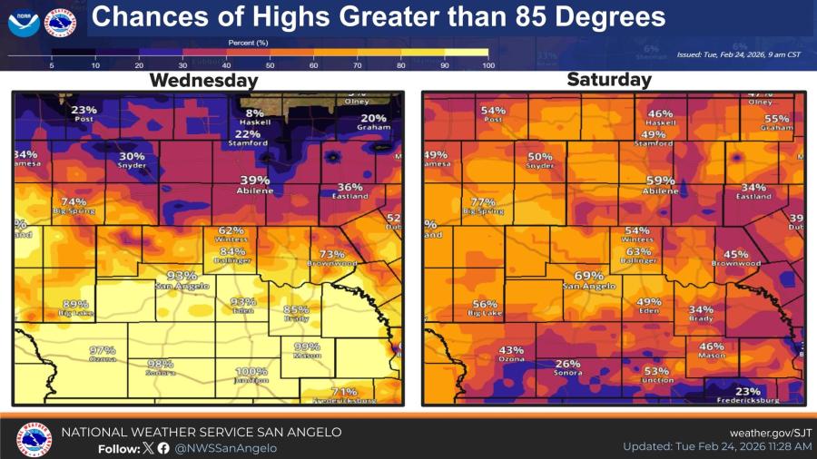
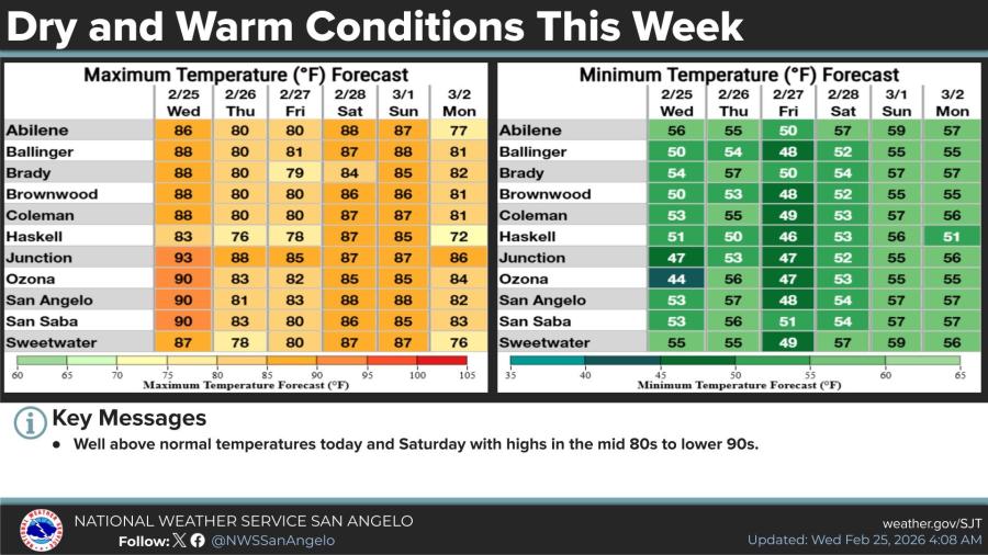
The hot pattern continues this week, with highs in the mid-80s to lower 90s persisting through Saturday in many locations. Wednesday and Saturday are forecast to be the warmest days, with some spots nearing 90 degrees and potential record highs possible in Abilene and San Angelo on Saturday.
Minimum temperatures overnight will stay mild, mostly in the 50s, providing little relief from the dry conditions.


")
Subscribe to the LIVE! Daily

Required
Post a comment to this article here: