
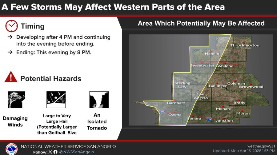
SAN ANGELO, TX — A few storms could bring damaging winds, large to very large hail and a low risk of an isolated tornado to western parts of the Big Country, Concho Valley and Crockett County late Monday afternoon and evening, the National Weather Service said.
Storms may develop after 4 p.m. along an approaching dryline and continue into the evening before ending by 8 p.m., the NWS office in San Angelo/Abilene reported. The dryline is forecast to stretch from near Rotan to Sterling City and into northwestern Crockett County by late afternoon.
Warm and humid conditions are in place across the area ahead of the boundary. Any storms that form between 4 p.m. and 6 p.m. would move eastward into the western portions of the region.
Hazards include large to very large hail, potentially exceeding golfball size, along with damaging winds. An isolated tornado is possible, but the risk is low.
A graphic released by the service is below:


")
Subscribe to the LIVE! Daily

Required
Post a comment to this article here: