

SAN ANGELO, TX — Showers and thunderstorms are expected to increase Tuesday night through Thursday across West Central Texas, bringing a risk of heavy rainfall and flash flooding, the National Weather Service in San Angelo reported. A slight risk of severe storms is also forecast Wednesday afternoon and overnight.
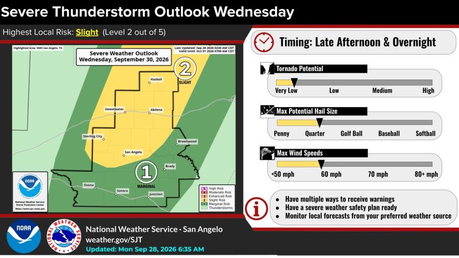
The highest local severe risk Wednesday is slight, or Level 2 of 5. Storms are expected late afternoon into overnight, with a low tornado potential, hail up to quarter size and wind gusts around 60 mph. A few storms may become severe, particularly in the Big Country and Concho Valley near Abilene, Sweetwater, Haskell, San Angelo, Sterling City, Brownwood and Brady.
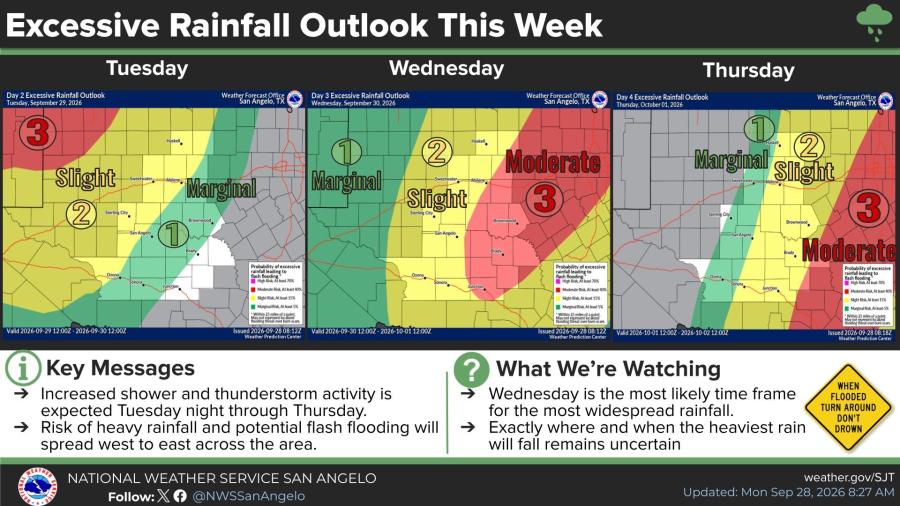
Increased shower and thunderstorm activity is forecast to spread from west to east Tuesday night through Thursday. Wednesday is the most likely period for the most widespread rainfall, though the exact location and timing of the heaviest amounts remain uncertain. Portions of the area face a moderate risk of excessive rainfall that could produce flash flooding.
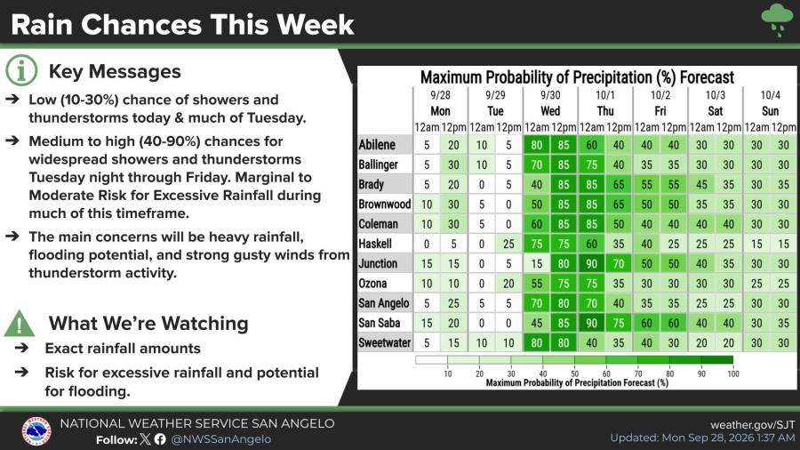
Rain chances stay low, 10-30%, through much of Tuesday before rising to 40-90% Tuesday night through Friday. Cities including Abilene, San Angelo, Ballinger, Brady, Brownwood, Junction, and San Saba show some of the higher probabilities Wednesday and Thursday. Main concerns with any storms are heavy rainfall, flooding, and strong gusty winds.
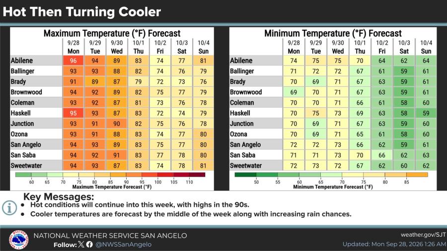
Hot weather continues early in the week, with highs in the low to mid-90s on Monday and Tuesday. Temperatures then trend cooler, with highs falling into the 70s by Friday as rain chances increase. Overnight lows start in the upper 60s to mid-70s and drop into the upper 50s and 60s later in the week.

Subscribe to the LIVE! Daily

Required
Post a comment to this article here: