

SAN ANGELO, TX — Low to medium chances of showers and thunderstorms return to West Central Texas from Wednesday into Thursday night, the National Weather Service said Monday, as an Extreme Heat Warning remains in effect for much of the region.
Probabilities range from 20% to 50%, with the highest odds Thursday afternoon and evening. Junction reaches 50%, while Brownwood, Coleman, Ozona, San Angelo and San Saba hit 40%. Abilene peaks at 30%.

Although most of the area is expected to stay dry, any storms that develop could produce locally heavy rain and strong, gusty winds.
An Extreme Heat Warning and Heat Advisory are in effect across most of West Central Texas from 1 p.m. to 7 p.m. Monday, with highs of 105 to 111 degrees.
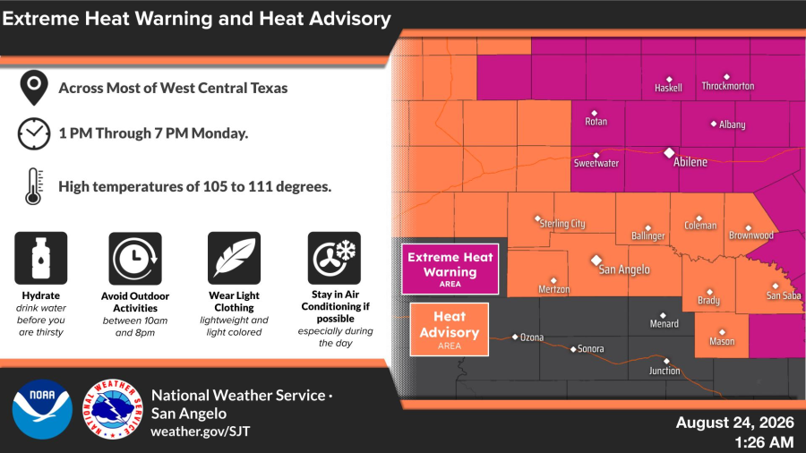
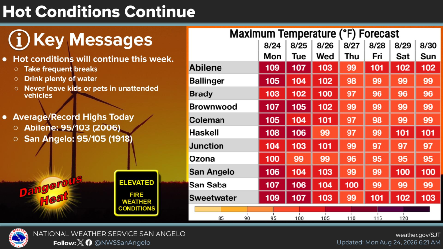
Hot conditions continue through the week, with highs ranging from the upper 90s to around 110.

Subscribe to the LIVE! Daily

Required
Post a comment to this article here: