

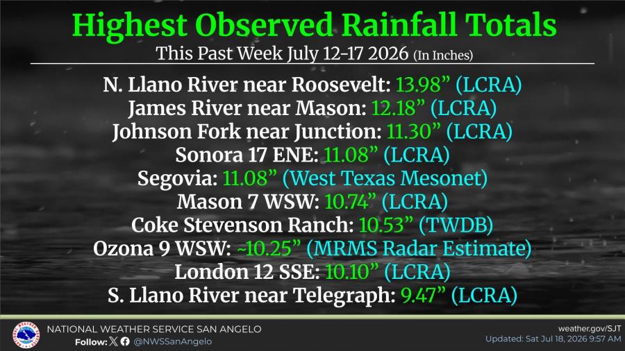
SAN ANGELO, TX - The highest rainfall total from the July 12-17 storm reached 13.98 inches at a gauge on the North Llano River near the small community of Roosevelt in Kimble County.
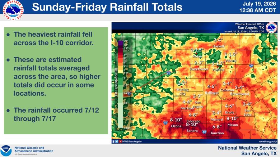
Other high amounts included 12.18 inches at the James River near Mason, 11.30 inches at Johnson Fork near Junction, 11.08 inches at both Sonora 17 ENE and Segovia, and 10.74 inches at Mason 7 WSW. Rainfall was heaviest along the I-10 corridor, with estimated totals of 8-10 inches near Ozona, Sonora and Eldorado.
San Angelo recorded about two to three inches of rain during the time, as shown in a graph below.
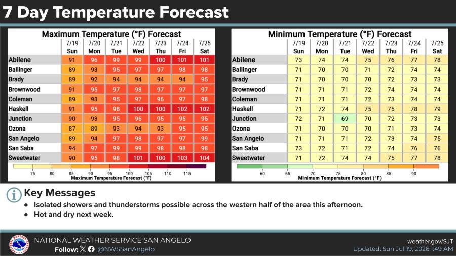
The seven-day temperature forecast shows hot and mostly dry conditions across West Central Texas through next weekend, with temperatures rising through the week. Highs are expected to reach the upper 90s and low 100s, including 101 in Abilene by Thursday and Friday, 102 in Haskell, and 104 in Sweetwater by Saturday. Lows will generally stay in the 70s. Isolated showers and thunderstorms are possible this afternoon across the western half of the area.
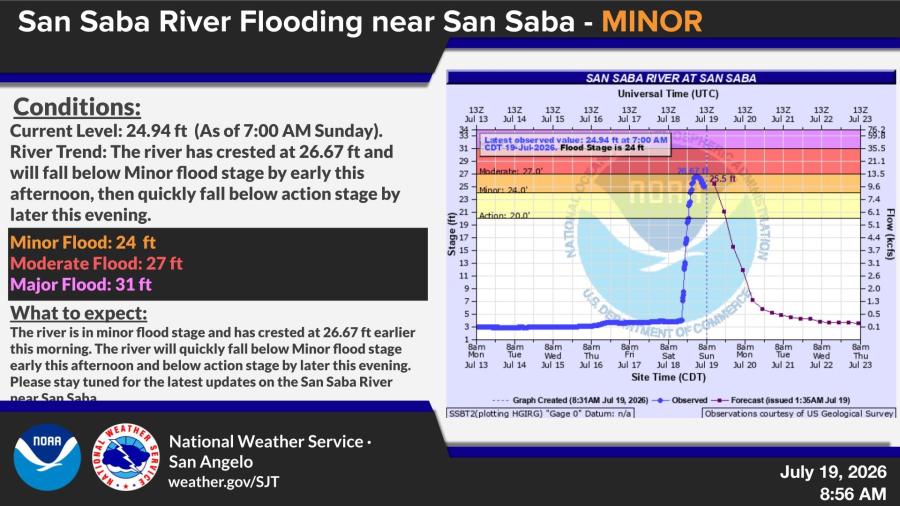
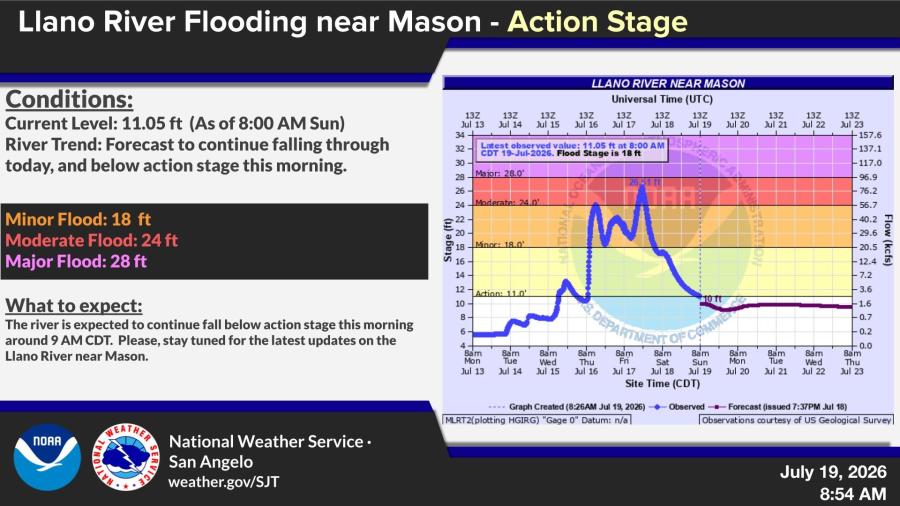
The heavy rain caused catastrophic flooding impacts in parts of the Northwest Hill Country and Northern Edwards Plateau. As of Sunday morning, the San Saba River near San Saba was at 24.94 feet in minor flood stage after cresting at 26.67 feet and falling. The Llano River near Mason was at 11.05 feet above action stage but expected to drop below it around 9 a.m.

Subscribe to the LIVE! Daily

Required
Post a comment to this article here: