
SAN ANGELO, TX — Hot and dry conditions will dominate West Central Texas this week, with the National Weather Service in San Angelo warning of increasing heat risk that reaches its peak by late week and into the weekend.
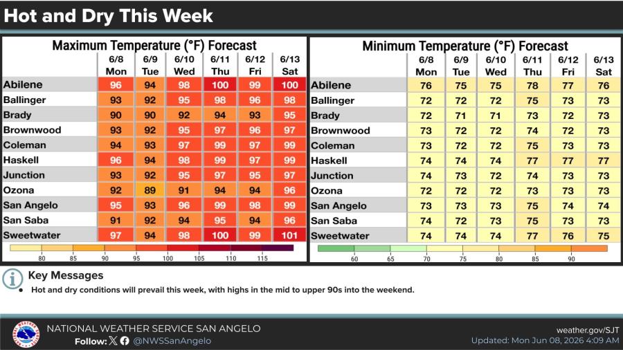
Upper-level ridging will bring summer-like temperatures and little to no chance of precipitation through the seven-day forecast, forecasters said Monday. Highs are expected to climb into the mid- to upper 90s, with some locations reaching 100 degrees or higher by Thursday. Combined with high humidity, heat index values could hit or exceed 105 degrees.
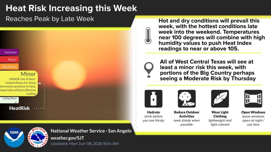
All of West Central Texas will experience at least a minor risk of heat-related illness, with portions of the Big Country possibly reaching moderate risk by Thursday, the NWS said. Overnight lows will remain in the low to mid-70s.
Similar warming is forecast for Ballinger, Brady, Brownwood, Coleman, Haskell, Junction and Ozona.
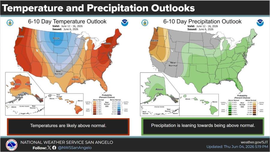
The 6- to 10-day outlook, valid June 12-16, shows temperatures likely above normal across the region. Precipitation is leaning toward above normal in that period. The NWS noted a pattern change next week may bring a better chance for rain beyond the current seven-day forecast.

")

Subscribe to the LIVE! Daily

Required
Post a comment to this article here: