
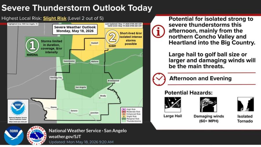
SAN ANGELO, TX — Isolated strong to severe thunderstorms are possible across West Central Texas this afternoon and evening, with the National Weather Service in San Angelo forecasting a slight risk of severe weather mainly north of Interstate 20.
The highest local risk on Monday is a slight risk (Level 2 out of 5) for short-lived or isolated intense storms, according to the NWS Severe Thunderstorm Outlook issued early Monday. A marginal risk extends south to Mertzon, San Angelo, Eden and Brownwood. Forecasters say large hail and damaging winds of 60 mph or greater are the main threats, with an isolated tornado possible.
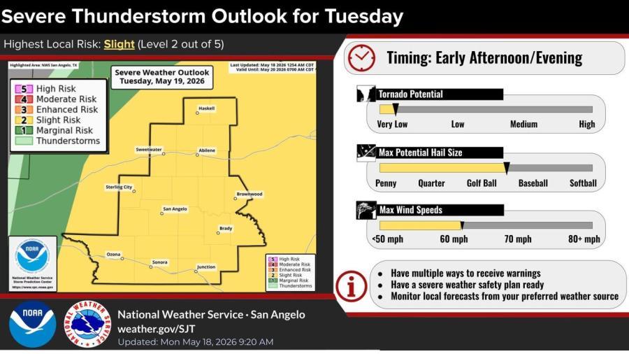
On Tuesday, a slight risk of severe thunderstorms covers all of West Central Texas, with storms expected in the early afternoon and evening. Large hail — potentially greater than 2 inches in diameter — and damaging winds are the primary hazards, the outlook said.
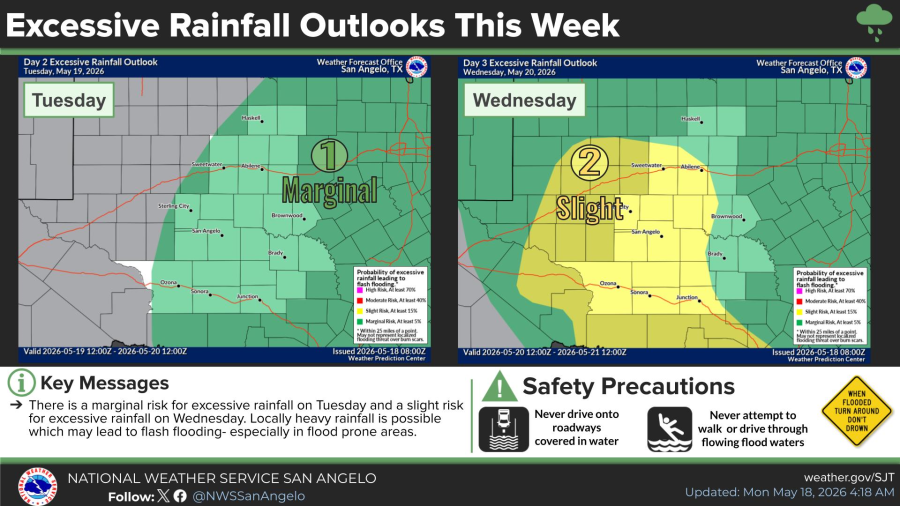
The NWS also issued excessive rainfall outlooks showing a marginal risk for flash flooding Tuesday and a slight risk Wednesday, especially in low-lying and urban areas. Periods of locally heavy rainfall are possible both days.
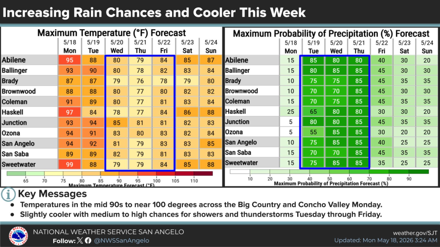
Temperatures will reach the mid-90s to near 100 across the Big Country and Concho Valley on Monday. A slightly cooler trend is forecast midweek, with medium to high chances for showers and thunderstorms Tuesday through Friday.
Residents should have multiple ways to receive warnings, prepare a severe weather safety plan and never drive through flooded roadways, the NWS advised.


")
Subscribe to the LIVE! Daily

Required
Post a comment to this article here: