
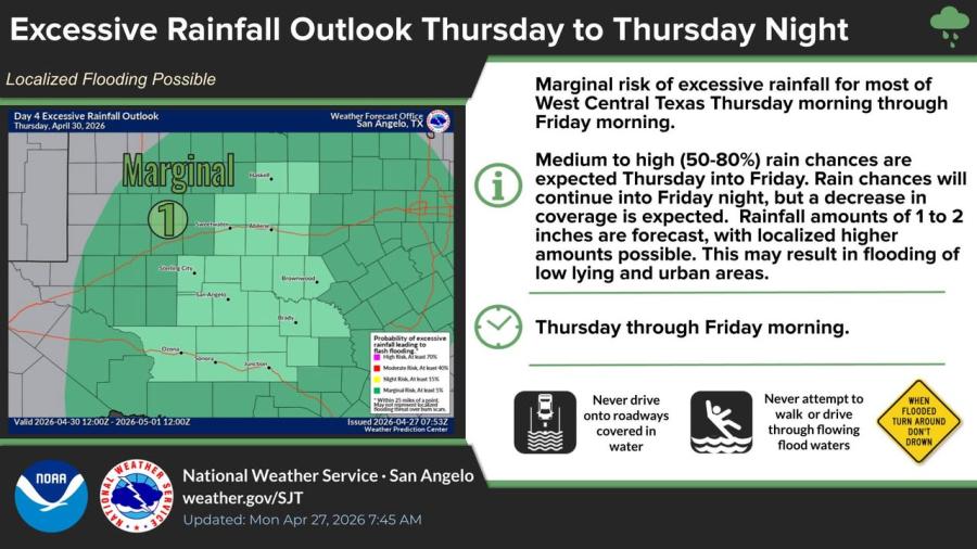
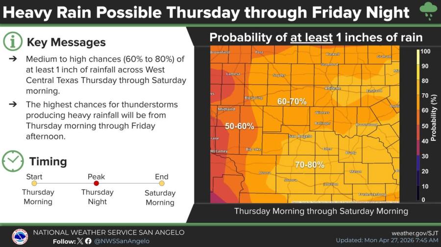
SAN ANGELO, TX — The National Weather Service has placed most of West Central Texas under a marginal risk of excessive rainfall Thursday morning through Friday night, with medium to high chances of showers and thunderstorms that could bring up to an inch of rain possible and localized flooding a concern.
Rain chances of 50% to 80% are forecast Thursday into Friday, continuing at a reduced level into Friday night, forecasters said. Some areas could see higher amounts. The highest threat for heavy rainfall from thunderstorms is expected Thursday morning through Friday afternoon, with a 60% to 80% probability of at least 1 inch across much of the region through Saturday morning.
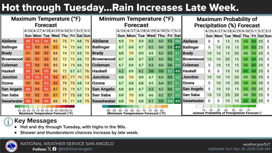
Through Tuesday, the region will remain hot and dry with afternoon highs in the 90s. A few isolated thunderstorms are possible Monday, but the chance is small and most areas will stay hot and dry, the NWS said. Temperatures will begin to moderate midweek before the rain arrives.
“Never drive onto roadways covered in water,” the NWS advisory states. “Never attempt to walk or drive through flowing flood waters.”
The forecast is subject to change as the system approaches, officials stated.


")
Subscribe to the LIVE! Daily

Required
Post a comment to this article here: