
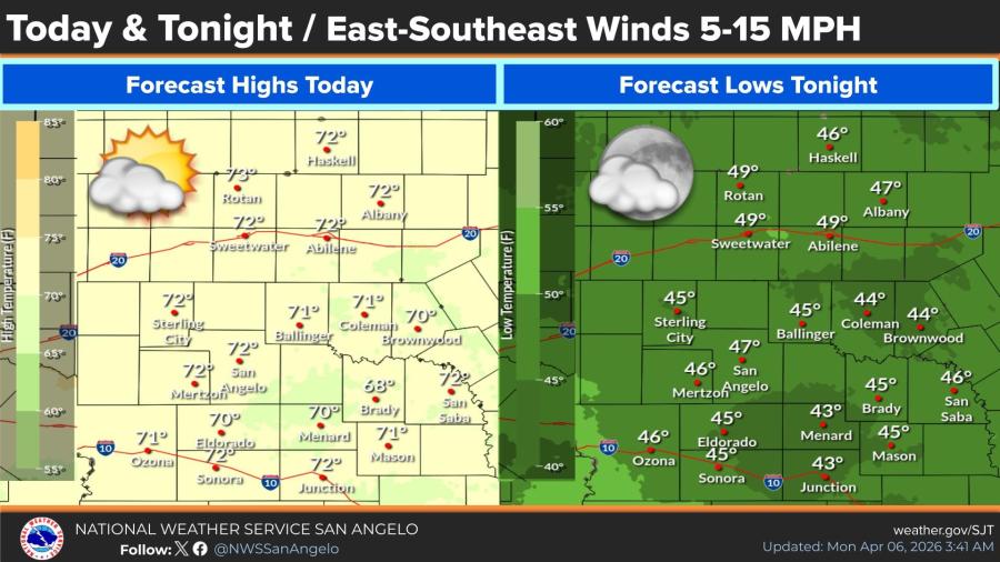
SAN ANGELO, TX — Cool and quiet weather will prevail across West Central Texas today and tonight, with highs in the low 70s and lows in the mid-40s, according to the National Weather Service.
East-southeast winds of 5 to 15 mph are expected, with partly cloudy to mostly clear skies. High temperatures Monday are forecast near 72 degrees in San Angelo and Abilene, 73 in Rotan, 70 in Brownwood and 68 in Brady. Overnight lows will dip to 47 degrees in San Angelo, 49 in Abilene and 43-49 degrees across most of the region.
A warming trend begins midweek, with highs climbing into the low to mid-80s by Thursday and Friday in many communities. The NWS forecast shows Abilene reaching 84 Thursday and 82 Friday, while San Angelo is expected to hit 83 Thursday and 82 Friday. Temperatures will remain above normal through the weekend, with daily highs generally in the upper 70s to low 80s.
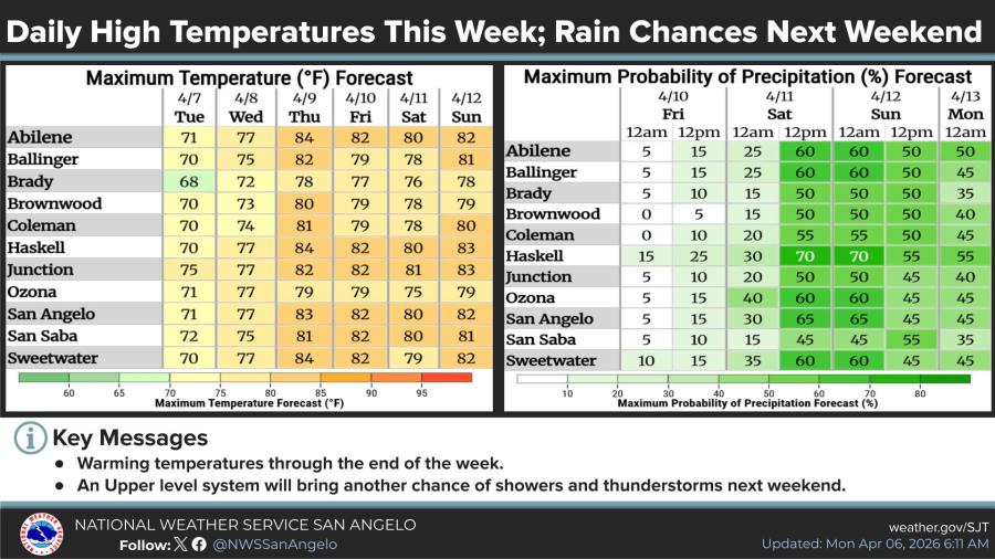
Conditions will stay mainly dry through Thursday. An upper-level system is forecast to bring increasing chances of showers and thunderstorms late this week and into the weekend, with precipitation probabilities rising to 45-70 percent Saturday across the area. Higher chances, near 70 percent, are possible in Haskell.
The NWS said cooler-than-normal readings will persist through Tuesday before the warming pattern takes hold.


")
Subscribe to the LIVE! Daily

Required
Post a comment to this article here: