
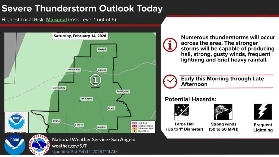
SAN ANGELO, TX — West-central Texas, including San Angelo, faces a marginal risk of severe thunderstorms Saturday, with the strongest storms capable of producing large hail up to 1 inch in diameter, gusty winds of 50 to 60 mph, frequent lightning, and brief heavy rainfall.
The National Weather Service in San Angelo issued the outlook early Saturday, forecasting numerous thunderstorms across the region from early morning through late afternoon.
Radar imagery shortly before 11 a.m. showed showers and thunderstorms increasing to the west and northwest, gradually overspreading the area into the afternoon.
Today’s forecast calls for showers and a possible thunderstorm before noon, followed by a chance of showers between noon and 3 p.m. Skies will be mostly sunny otherwise, with a high near 74. West winds of 10 to 15 mph could gust as high as 25 mph. The chance of precipitation is 70%, though new rainfall amounts will generally be less than a tenth of an inch except in thunderstorms.
Tonight will be clear with a low around 48 and northwest winds of 5 to 10 mph, gusting to 20 mph.
Sunday will be sunny with a high near 73, followed by mostly clear conditions Sunday night and a low around 42.
The warming trend continues into next week, with highs in the low to mid-80s expected Tuesday through Thursday under mostly sunny to partly cloudy skies.
You can view the radar by clicking HERE.


")
Subscribe to the LIVE! Daily

Required
Post a comment to this article here: