
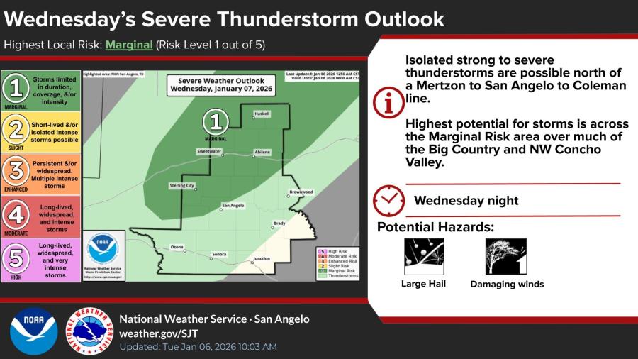
SAN ANGELO, TX — Isolated strong to severe thunderstorms are possible across parts of West Central Texas tonight into Thursday morning, with large hail and damaging winds as the primary threats, according to the National Weather Service in San Angelo.
The agency has issued a marginal risk — Level 1 out of 5 — for severe weather Wednesday night, mainly north of a line from Mertzon to San Angelo to Coleman. The highest potential is across the Big Country and northwest Concho Valley.
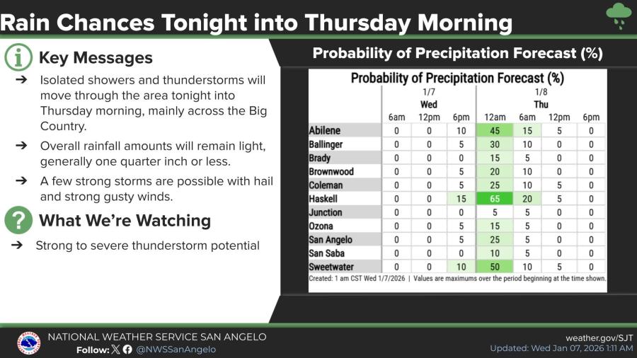
Forecasters said overall rainfall will remain light, generally a quarter-inch or less, though a few strong storms could produce hail and gusty winds. Isolated showers and thunderstorms are expected to move through the region, primarily affecting the Big Country.
Probability of precipitation is highest in Haskell (65% around midnight) and Sweetwater (50%), with lower chances elsewhere, including 45% in Abilene and 25% in San Angelo.
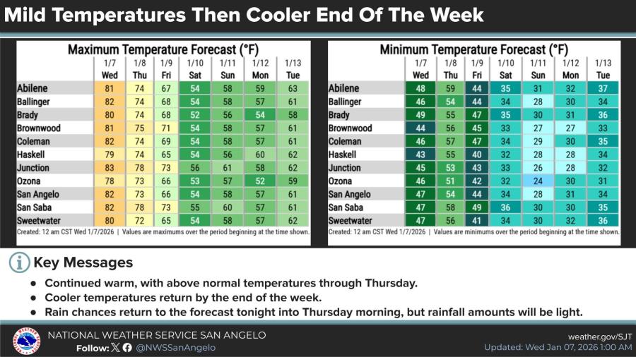
Temperatures will remain above normal through Thursday, with highs in the upper 70s to low 80s Wednesday and Thursday, before cooler air arrives late in the week. Highs are expected to drop into the 50s by Saturday and Sunday across most of the area.


")
Subscribe to the LIVE! Daily

Required
Post a comment to this article here: